
-
Register Now for a Free Account!Unlock additional site access with your free account today, takes less than a minute, and guaranteed no spam - ever. Register Now!
Cruising Earth
Category 5 Hurricane Humberto (2025) Historical Storm Tracking
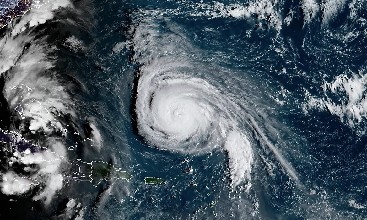
Category 5 Hurricane Humberto (2025) Last Known Position
Last Known Position Data
Date / Time
10-1-2025 11:00 AM ADT
Coordinates
37.00°N -63.00°W
Movement
ENE at 23 mph
Minimum Central Pressure
980 mb | 28.94 inHg
Maximum Sustained Winds
70 mph (TS)
Tropical Storm Force Winds Extend Out
265 miles
Category 5 Hurricane Humberto (2025) Historical Storm Path
Last Reported Location
Last Reported Coordinates
37.00°N -63.00°W
Last Reported Movement
ENE at 23 mph

Loading storm tracking map...
Map Legend:
- Tropical Depression
- Tropical Storm
- Hurricane
- Projected Landfall
- Tropical Storm Wind Field
- Hurricane Wind Field
Select on map markers to view additional details for that location. Landfall occurs when the center of the tropical cyclone moves across the coast. Wind fields shown are approximate visualizations based on official wind radii. Actual wind coverage is rarely symmetrical and can vary significantly by storm, with stronger winds often extending much farther in one direction than another.
Category 5 Hurricane Humberto (2025) At Peak Intensity
Peak Intensity Data
Peak Intensity
Category 5 Hurricane - 160 mph
Coordinates
23.40°N -62.10°W
Minimum Central Pressure
924 mb | 27.29 inHg
Maximum Sustained Winds
160 mph (Cat 5)
Recorded Local Time
September 27, 2025 at 11:00PM ADT
Recorded Zulu Time
September 28, 2025 at 02:00 Z
Peak Intensity Satellite Imagery
Coverage Area
Atlantic Ocean - Tropical
Satellite
GOES-East
Imagery Type
GeoColor
Image Format
Composite Loop

Satellite imagery times are typically shown in Zulu Time (Z), which is equivalent to UTC and GMT.
Severe Weather Information
Cruising Earth is not an official weather authority. For severe weather forecasts, watches, warnings, and emergency information, always rely on your national, regional, or local weather service. Use official guidance when making decisions to protect yourself, your family, and your property.
Weather-Related Delays & Itinerary Changes
Cruise itineraries may change because of weather or other operational conditions. Always check directly with your cruise line for the latest schedule changes, travel advisories, and itinerary updates. Many cruise lines also offer email and text notifications for booked guests.