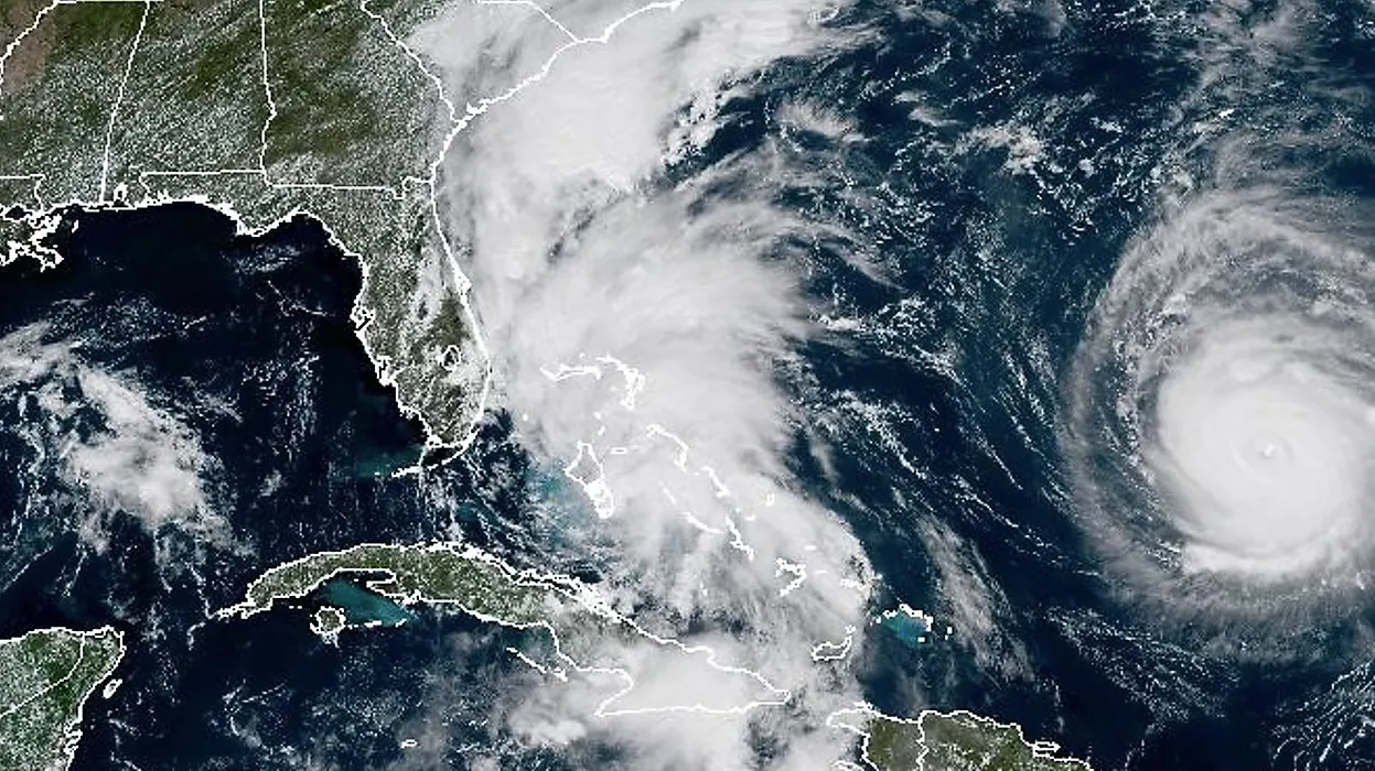
Hurricane Imelda, the ninth named storm of the 2025 Atlantic hurricane season, has intensified into a Category 2 storm as it tracks directly toward Bermuda. Originating in the central Atlantic, Imelda strengthened rapidly on Tuesday, with maximum sustained winds reaching 100 mph and moving east-northeast at 20 mph. Forecasters predict it will pass over or very near the island early Thursday morning, October 2, 2025, potentially making landfall as a Category 2 hurricane.
The storm's path has prompted Bermuda to brace for severe impacts, including destructive winds up to 100 mph, heavy rainfall exceeding 5 inches, and significant coastal flooding from storm surge and powerful waves. Dangerous surf and rip currents are already affecting the U.S. East Coast, though Imelda is steering away from the mainland. Bermuda's government has closed airports, schools, and offices, urging residents to secure properties and stock up on essentials.
After brushing Bermuda, Imelda is forecast to curve northeast into the open Atlantic, potentially intensifying briefly before encountering cooler waters and shear. View the impact of Hurricane Imelda through live cameras at the link below.
Category 2 Hurricane Imelda (2025) Historical Storm Tracking, Data, And Imagery
View Category 2 Hurricane Imelda (2025) historical storm track and data, satellite imagery at landfall, and impact. Explore historical data like storm intensity, wind speeds, movement, pressure, and landfall locations from Imelda's development to dissipation.
Category 2 Hurricane Imelda (2025) Historical Cameras
Category 2 Hurricane Imelda (2025) live streaming cameras show historical locations along the storm’s path. See lingering damage, ongoing recovery efforts, and real-time conditions in areas impacted by Imelda's landfall.