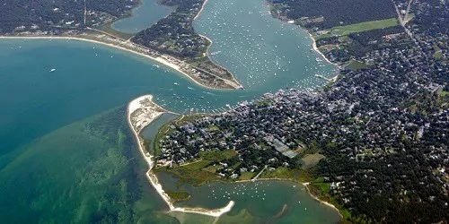
Port of Martha's Vineyard, Massachusetts
Real-Time Live Ship & Marine Traffic

Port City Details & Statistics
|
Tue Jul 08, 2025
11:44 AM EDT 80 °F
Few Clouds
|
|
Population: Pop. Year: Land Area: Density: Latitude: Longitude: Timezone: |
16,535 2010
87.5 mi2
189 / mi2 70.5994° W UTC -04:00 |
View Real-Time Live Ship Traffic In The Port of Martha's Vineyard, Massachusetts
Track ship arrivals and departures in the Port of Martha's Vineyard, Massachusetts. Real-time live ship traffic in the Port of Martha's Vineyard, Massachusetts is now centered in the port tracker below.
Additional Ports Nearby
- New Bedford, Massachusetts - 20.57 miles (NW)
- Nantucket, Massachusetts - 28.62 miles (SE)
- Fall River, Massachusetts - 33.98 miles (NW)
- Newport, Rhode Island - 37.35 miles (W)
- Providence, Rhode Island - 48.16 miles (NW)
- Boston, Massachusetts - 65.14 miles (N)
- Gloucester, Massachusetts - 80.05 miles (N)
View Another Port
Track Cruise Ships, Cruise Ferries, Research Ships, Military Ships and Famous Ships right here live on Cruising Earth!
Tracker Legend:
- Cargo
- Tanker
- Cruise / Passenger
- High Speed
- Military / Special
- Fishing
- Pleasure
- Navigation Aids
Ship Tracking 101: Why is the ship I'm trying to track not updating?
Cruise Weather
Get the latest current and forecast weather information that may affect your cruise vacation travel plans.
Live Weather Radar Hurricane Tracker Hurricane Reconnaissance Tropical Weather Events Satellite Imagery Port Weather Weather Links