-
Register Now for a Free Account!Unlock additional site access with your free account today, takes less than a minute, and guaranteed no spam - ever. Register Now!
Tropical Storm Barry (2025) Historical Storm Tracking, Data, And Imagery - Cruising Earth
Tropical Storm Barry (2025) Historical Storm Tracking
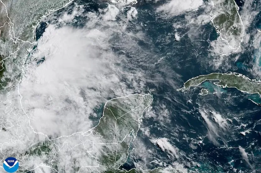
Tropical Storm Barry (2025) Landfall
Landfall Data
Date/Time: 6-29-2025 10:00 PM CDT
Landfall City/State: Tampico Alto, Mexico
Coordinates: 22.00°N -97.80°W
Moving: NW at 9 mph
Minimum Central Pressure: 1007 mb | 29.74 inHg
Maximum Sustained Winds: 35 mph (TD)
Tropical Storm Barry (2025) Historical Landfall Location
Landfall Location
Landfall City/State: Tampico Alto, Mexico
Landfall Coordinates: 22.00°N -97.80°W
Time Of Landfall = 6-29-2025 10:00 PM CDT
Movement At Landfall = NW at 9 mph
View enhanced tropical weather maps by becoming a Cruising Earth Patron Member. Standard map currently displayed below.
Map Legend:
- Tropical Depression
- Tropical Storm
- Hurricane
- Projected Landfall
- Tropical Storm Wind Field
- Hurricane Wind Field
Landfall occurs when the center of the tropical cyclone moves across the coast. Select on map markers to view additional details for that location.
Tropical Storm Barry (2025)
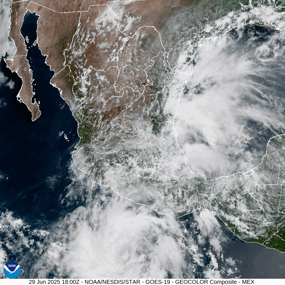
Landfall #1: Tampico Alto, Mexico
Landfall Location
Landfall City/State: Tampico Alto, Mexico
Landfall Coordinates: 22.00°N -97.80°W
Time Of Landfall = 6-29-2025 10:00 PM CDT
Movement At Landfall = NW at 9 mph
Landfall Satellite Imagery
Mexico [GOES-East GeoColor] Composite Loop during Tampico Alto, Mexico Landfall
Severe Weather Information
Cruising Earth is not an official source for severe weather information. Please refer to your region's official weather service as your primary source for severe weather updates and decision-making to keep you and your family safe.
Cruising Earth is not an official source for severe weather information. Please refer to your region's official weather service as your primary source for severe weather updates and decision-making to keep you and your family safe.
Weather Related Cruise Delays & Itinerary Changes
Check directly with your cruise line for any potential weather-related delays or itinerary changes. Many cruise lines also offer online sign-ups for weather alerts via email or text message specific to your cruise.
Check directly with your cruise line for any potential weather-related delays or itinerary changes. Many cruise lines also offer online sign-ups for weather alerts via email or text message specific to your cruise.